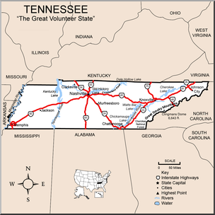
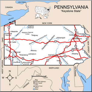
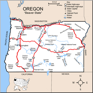
United States Maps Clip Art Worksheets for Students – Dive into educational worksheets showcasing clip art of U.S. maps, perfect for students studying American geography.
United States Maps Clip Art Worksheets for Students – Dive into educational worksheets showcasing clip art of U.S. maps, perfect for students studying American geography.
1.1. The abcteach.com public and membership websites have been in operation since about 2000, providing access to downloadable materials for educators and parents.
1.2. The abcteach.com website is owned and operated by ABCTEACH LLC, a Michigan limited liability company. The names "abcteach" and "abctools" are registered trademarks. As used in this Terms of Service and Privacy Policy, "We" and "abcteach" and "Site" refer to all websites and services, whether public or membership, operated or offered by abcteach. Currently we operate under the following base urls: abcteach.com, and members.abcteach.com.
1.3. abcteach is for use by parents, educators, and others over the age of 18. The materials made available by abcteach are intended to be used with and for children and students, among others, at the discretion and under the control, supervision, and direction of the parents, educators, and other adults who are visitors, members, or subscribers to the Site. As used in this Terms of Service and Privacy Policy, "you" refers to such visitors, members, or subscribers.
1.4. By using the Site, you accept and agree to be bound by the following terms. We may, solely at our discretion, modify or revise these terms and conditions at any time by updating this web page, and you agree to be bound by these modifications or revisions. You should visit this page periodically to review the terms. From time to time, we will require that you confirm your agreement to the terms.
2.1. Sharing of password or login information is strictly prohibited. Suspension of account access may result from sharing of this information.
2.2. Worksheets and other materials available on abcteach, including clip art, may be printed or otherwise duplicated for use in your home or your classroom(s). Clip art on abcteach is intended as a resource for you in creating lessons and teaching materials and the like within your permitted usage of the Site. If you are a paid member, our clip art may be: placed on another publication as clip art, or distributed individually on a third-party authorship site, if you as a member give abcteach credit for any clip art intended to be redistributed. Giving credit to abcteach requires you to mention our name and website on any publications in which you use our clip art for redistribution. You may not use our clip art in the design or content of another website; or distribute our clip art electronically or by email or text or by any other media or social media. Furthermore, Members are prohibited from packaging our clip art into their own collections for sale, each clip art illustration used for resale, must be used individually, again giving credit to abcteach.com.
2.3. The abcteach copyright appears on every page; we require that this copyright remain in place on all reproductions.
2.4. Except as provided in section 2.7 below, all of the worksheets and other materials available on abcteach are intended for non-commercial educational purposes.
2.5. You may place links to abcteach from your own education website; however, copying or uploading abcteach resources and documents to your own site is a copyright violation and will be treated as such. Deep linking is not permitted. (A "deep link" is a hyperlink that bypasses a website's home page and takes the user directly to an internal page. For example, instead of linking to the home page of a newspaper, a deep link might take the user directly to a newspaper article within the site.) At abcteach, linking directly to a content page rather than the home page or a directory page is considered deep linking and is not permitted.
2.6. Under no circumstances may any of the documents, resources, clip art, worksheets, or other materials (including text, images, or website design) on abcteach be re-sold or re-distributed without the express permission of abcteach.
2.7. We may permit you to use abcteach materials in your creation and sale of educational materials produced by you individually, on sites such as Teachers Pay Teachers, upon your payment of a separate additional fee and your submission of an executed agreement as stated elsewhere on the Site. This would offer you a limited non-exclusive license to use abcteach materials within the scope of the separate agreement; such permission being terminable at any time by abcteach in our sole discretion; you agree that you will immediately cease the use, or offering for sale, or sale, of any such educational materials in the event we take such action. By using any materials, you acknowledge that other members may be acting under similar permissions and creating similar materials.
2.8. If you desire to use abcteach materials in any other manner, or if you have any questions about permissible uses that are not specifically addressed here, you should address your inquiry to support@abcteach.
3.1. The Site has tools and other features, including but not limited to abctools, the abcWorkshop, and other applications, that facilitate the creation of user-generated word lists, puzzles, worksheets, and other resources. The user-selected content of such user-generated materials is your sole responsibility and not that of abcteach. If any other person, including children or students, uses your member account to access or use abctools or abcWorkshop or any other abcteach application, you agree to and assume responsibility for any such materials.
3.2. You are responsible for assuring that any materials, lists, documents or other documents created with this abcteach tools, resources, and applications, are appropriate, and you will not cause or permit the tool to be used to create harmful, vulgar, threatening, or otherwise inappropriate content.
3.3. If you share an abcteach document or user-generated document, by any means including any of the sharing features or applications or tools found on the Site, you are solely responsible for the content of the transmitted materials or documents.
3.4. If any sensitive materials or information or documents from the Site, or user-generated materials, are shared or provided to a child under the age of 13, you agree that you will first obtain express consent from the child’s parent or guardian(s) to share such documents with the child, and obtain permission and/or releases for the use of any user-generated information concerning the child or the child’s family that may be contained in such documents.
By posting information on or through our Sites, you automatically grant abcteach a royalty-free, perpetual, irrevocable, non-exclusive license to use, reproduce, modify, publish, edit, translate, distribute, perform, and display the information, alone or as part of other works, in any form, media, or technology, whether now known or hereafter developed, and to sublicense such rights through multiple tiers of sub-licensees.
5.1. We currently offer one-year and two-year individual memberships for single payment, and a monthly plan with payment of an initial setup charge followed by monthly payments. We also offer group memberships to schools, districts, and groups, the details of which are described separately. The terms and prices of individual memberships as they may exist from time to time are stated on the Site. We may choose to offer different membership plans. By becoming an abcteach member, you agree that we may renew your subscription automatically for the same subscription terms on the day your previous subscription ends, and you authorize us to charge you for the subscription term, unless you cancel your account prior to its renewal date through the cancellation process, as provided in sections 5.4 – 5.6 below.
5.2. We use third-party payment providers (such as CyberSource and other providers) for all credit and debit card and PayPal and similar transactions. We do not collect or retain information about user’s credit or debit cards or PayPal accounts or other payment mechanism, all of
which information is retained and used according to secure procedures of the third-party payment providers.
5.3. Depending on the plan you choose, you will be charged a fee automatically through our renewal system. By becoming an abcteach member, you are agreeing that we are authorized to charge you the membership fee associated with the type of membership (monthly, yearly, or bi-yearly) that you chose during registration. You agree that we are authorized to charge you the membership fee at the then-current rate to the payment method you provided during registration. Please note that prices and charges are subject to change without notice. Fees each month may be modified using credit card, debit card, PayPal, or other payment methods available through your account. This includes:
promotional discounts advertised in our weekly member newsletters, or on-brand promotional ads. Each renewal payment will take place on or about the anniversary of the original date of account registration. If all eligible payments methods we have on file for you are declined, you must provide us a new payment method promptly or your membership will be canceled. If the renewal of your membership fails for any reason, we will attempt to process your renewal for a period up to thirty (10) days.
5.4. Membership Cancellation. You may cancel your membership any time by visiting Your Account and adjusting your settings. If you choose to cancel your subscription or fail to pay any fees, we may stop your membership. If you cancel your membership or are no longer a paid user, you have the option to continue use as a free user.
5.5. UNLESS YOU NOTIFY US BEFORE A SUBSCRIPTION PAYMENT THAT YOU WANT TO CANCEL OR DO NOT WANT TO AUTO RENEW, YOU UNDERSTAND THAT YOUR ABCTEACH MEMBERSHIP WILL AUTOMATICALLY CONTINUE AND YOU AUTHORIZE US TO COLLECT THE THEN-APPLICABLE
MEMBERSHIP FEE AND ANY APPLICABLE TAXES, USING ANY/ ALL ELIGIBLE PAYMENT METHODS WE HAVE ON RECORD FOR YOUR ACCOUNT.
5.6. ALL FEES ARE NON-REFUNDABLE. Termination of your account
may include removal of your access to all offerings of the website; including password, information, files, and user content associated with your account, and barring any further use of abcteach membership services and tools.
5.7. We may terminate your membership at our discretion without notice. If we do so, we will provide a prorated refund based on the number of days/months remaining in your membership. However, we will not give any refund for termination related to conduct that we determine, in our discretion, violates these terms or any applicable law, involves fraud or misuse of the membership agreement, or is harmful to our interests or another use.
5.8. By applying for membership, you represent that: you are over the age of 18; that you are competent to enter into a contract; that you are the owner of, or authorized by the owner, to utilize the credit or debit card or other payment mechanism used for the payments; that the information you submit about your location and contact information is correct; that you will promptly notify us of any change in your email address or payment mechanism; and that you have read and agree with the provision of these Terms of Service and Privacy Policy. We reserve the right to decline any application for membership, or to change the terms and/or conditions of any account at any time, for any reason or no reason.
5.9. We may offer, on the Site or through other means, and broadly or to limited groups of potential members, promotional prices, seasonal pricing, free trial memberships, or other special prices and terms. Such promotional activities do not affect existing memberships, and abcteach will not provide or offer such promotional prices to existing members or users, and will not provide refunds or rebates or other price protections.
REVISION DATE: August 1, 2017